|
|
THE WATERSHED
|
|
|
|
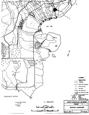
The historic Roche Point Creek watershed covered an area of 130 hectares, about 3 km in length and 1 km in width.
|
|
|
|
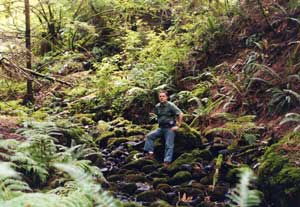
The present natural channels of Roche Point Creek now lie entirely within Roche Point Forest, which covers an area of about 23.5 hectares, in the lower watershed.
|
|
|
The upper watershed basin was altered by residential development, and essentially lost.
Throughout the middle watershed, parts of the main stream channel and tributaries were redirected and culverted during golf course construction in 1952.
The lower watershed was also altered, but has potential for restoration.
|
|
|
Roche Point Forest is worthy of conservation both in terms of its value as a rich and unique wildlife area and as a heritage forest. Roche Point Forest is also an integral part of the Cates Wildlife Corridor and contains old growth Douglas-firs used by bald eagles.
|